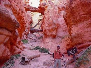
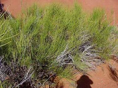
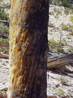
 Frozen
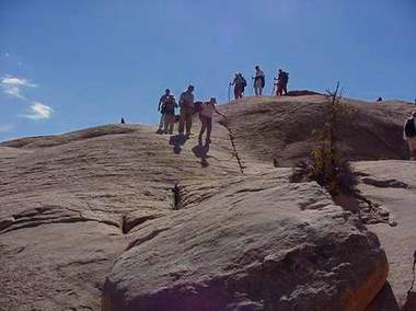
Men at Bryce
Frozen
Men at Bryce
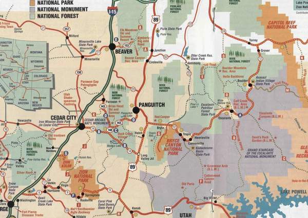
Hiking Zion, Bryce, and Capital Reef Canyons
October 1 October 11, 2000
Continue Page 3
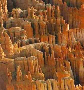
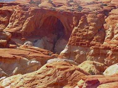
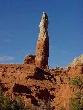
Bryce Canyon:
We spent three days at Zion and stayed in St. George. Next we moved to Rubys Inn, which is not a town but is close to Bryce Canyon. It was a huge place and Rubys was the only game in town. While the altitude at Zion was 7500 feet, Bryce was at 11000 feet. It was a red canyon, and bone dry.
The Canyons unusual formation was fascinating. The erosion was caused
by many factors such as uplift, frost, wind, rain and tree roots. The cliffs
do not lend themselves for sport climbing because they are soft limestone,
rough, and rather unstable. When one piece of it peels off, it tumbles
and disintegrates into sand. They form domes, pillars, and spires, which
are called Hoodoos. The word hoodoo is believed to be African meaning
pillar or cast a spell or bad luck. Indians thought the pillars and spires
were animal-like evil creatures that changed to frozen le. The coyotes
then turned them into stones.
Frozen
Men at Bryce
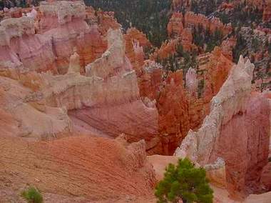
Unlike the Zion rocks, there was no water in the hoodoos of Bryce. We therefore did not see shrubs growing on the cliffs. The canyon was so dry that hikers are warned to carry drinking water. It was desolate and, except for the breeze, absolutely quiet.
Bryce Canyon was a masterpiece of erosion, a tapestry of great beauty commanding awe. It was very difficult for anyone to negotiate a passage through it. Early pioneers who had no appreciation for the beauty of nature and were concerned only for survival had derogatory names for the canyon. French fur trappers called it the bad land to cross, a name that was later shortened to The Badlands. Ebenezer Bryce, a Mormon Scottish immigrant, moved into the valley for grazing of his livestock. He later left the area, describing it as a hell of a place to lose a cow. The name Bryce Canyon stuck.
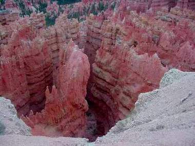
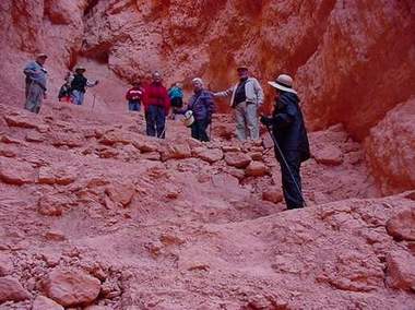
At Bryce, there was a very colorful red area known as Wall Street. It
was like standing on top of the Empire State building looking down at the
street below. It was very rugged to negotiate. We walked down on a switchback
path sometimes going through openings in the walls. When we reached the
bottom, the view was amazing. We must have walked down more than 500 feet.
Everyday we had a surprise, and all would say Ooh! Ah! The Wall Street
was no exception. Differential erosion takes place when cliffs erode unevenly
due to the composition of the sediment. The differential erosion made holes,
tunnels, and bridges. Rocks one day will tumble down and then Wall Street
is expected to close.
 |
 |
The loosely cemented sandstone eroded easier than did the limestone,
which left holes and caves in the rock.
 |
 |
Ron escorted us to areas that were not usually traveled by people; as a Park ranger he knew the area very well and also grew up there. On our hikes, we usually went around loops, so we did not return the same way. It seemed we were always climbing hard and through rough pathways. At one excursion, he said that he would take some of us who liked to go on a trek through the rough and undesignated routes. Half of us went with him and the others hiked back. Each one of us had a walking stick. We walked down through the bushes and over loose gravelly soil and rocks. We took small steps at a time with the sticks acting as third legs. Louisa slid in one place, but luckily did not go all the way down hundreds of feet. She had minor cuts. We saw different kinds of trees and shrubs. The scenes were breathtaking. It was scary at times but enjoyable.
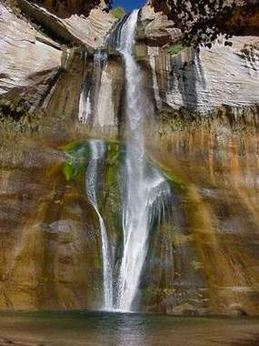
One of the easy trails was the one we followed to Calf Creek Fall in the Grand Staircase Escalante National Monument, named after a Spanish priest. The monument was a recent designation by President Clinton. The walk was very enjoyable, mostly sandy and flat along the Calf Creek. We saw many different shrubs and flowers. We reached the 120-foot fall. The sound of the water falling in a pond was refreshing and cool. Humans have always been fascinated with water, and this time was no exception.
Calf Creek Fall Crossing the Creek
 |
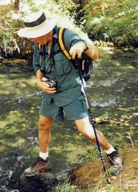 |
There were a few small trout in the river. On the way back, we passed several people with fishing gear. Brenda advised one, we saw about six trout in the Creek and a dozen fishermen going there, so hurry up!
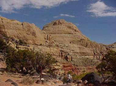
Capitol Reef:
After spending three days in Bryce, we headed for our last base in Bicknell
so we could visit Capitol Reef. The road to Bicknell was very scenic and
dotted with patches of Aspen trees turning yellow. A patch of Aspen is
one tree which has others sprouting out of its roots. 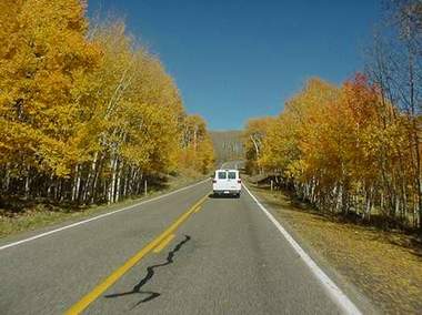
We stayed in a hospitable motel (The Aquarius), which had a restaurant
with excellent service and good food. One night, we asked the waitress
Daila what kind of a pie was in the glass case that she did not serve us.
She told us it was strawberry rhubarb and offered us some even though we
already had desert. We said we would try it tomorrow.
The Capitol Reef was a colorful rugged maze of rock formations with vast, deep canyons. The area was made famous when Butch Cassidy and his group used it as their hideout. There were few ways to get through the Reef. The gang knew the ways very well and had the advantage over their adversaries. The dome shaped rocks resemble the Capitol Hill in Washington and that was the reason for the name.
Cassidy's Arch Capitol Dome
 |
 |
The layers of the cliffs look like a multi layered cake with several
different colors. The sedimentary rocks display natural colors of white,
red, yellow, green, purple, and rust as if they were painted. Ron told
us of a visitor asking him when was the last time they were painted?
During a day from dawn to dusk, the shades of color change. 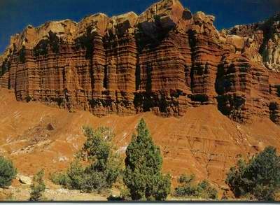 It
is interesting to see post cards of a cliff taken at different times of
a day. Professional photographers spend days waiting for the right shading
and illumination before they capture the scene.
It
is interesting to see post cards of a cliff taken at different times of
a day. Professional photographers spend days waiting for the right shading
and illumination before they capture the scene.
Adjacent to the park is the town of Fruita, which was first established by a Mormon leader. The leader settled in this area because he was a polyg, as the Mormons were called at the time. A community of polygamists thrived there for it was too rugged for the Feds to find them. When the lawmen came, they would hide their wives in a canyon known as Cohab Canyon. The area was suitable for cultivating fruits, which are planted even to this day. The fruit orchids had peaches, plums, apricots, quince and different varieties of apples planted and well cared for by the Park Service. The Fremont River runs through the landscape and supplies the orchids with water. Signs are in every orchid saying U PICK. It is free for the visitors. We did pick some and ate it. It was obvious that no pesticides were used on the fruit. We also picked what we thought was a golden delicious apple but when Ron bit into it, he did not like because it was quince. Permitting picking fruits was a good gesture on the part of the Park Service.
We hiked the Grand Wash Gorge and the Capitol Gorge [Pix: Canyon Gorge].
The pioneers were obviously there in the 1800s because we saw their dated
carvings on the Cliffs. The carvings were very high on the walls, so they
either reached from their wagons or the unlikely scenario that gorges
floor had settled. The gorge walk was flat and easy but sometimes rocky.
This was followed by a very strenuous hike on big dome rocks where it seems
one could slip down hundreds of feet. In fact, slipping mistakes are deadly
dangerous in all the canyons we visited. The terrain was all one huge rock
fused to another huge rock.The trails were marked by cairns, which were
small piles of small rocks. When we got to our destination at Cassidys
Arch, we felt like we were on top of the world. We had lunch there. Ron
told us that he had never walked over the arch because every time he tried
he got vertigo; it seemed very unusual for Ron to be intimidated by anything
in the wild. A few of us did walk on top of the arch, behind which there
was a deep well that seemed bottomless. Kay and I laid down our stomachs
at the edge and looked down and we could not see anything. From the
same vantage point we saw clearly Ferns nipple.
 |
 |
Fern's Nipple Hiking Down Cassidy's Arch
When blocks of rock fall off the cliff at the joints, they sometimes
leave circular niches, which eventually become an arch. Some arches like
Hickman have a span of more than 300. I could not photograph it so
I bought a post card. It is hard to believe that the bridge, like many
other bridges and arches, is natural in formation due to erosion. Erosion
is caused by many factors like wind, rain, temperature changes, roots,
and earthquakes.
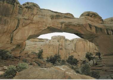 Hickman
Bridge(Post Card)
Hickman
Bridge(Post Card)
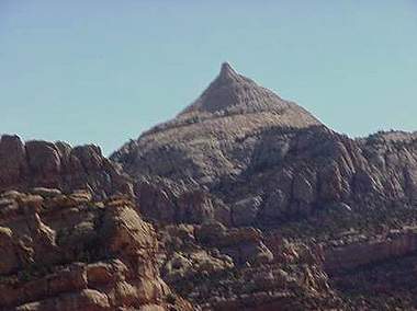
The plan was to visit the Chimney Rock on the last and third day. Unfortunately,
it rained for the first time on us and Ron went to Plan B: we walked up
to view Goosenecks, a sulfur creek canyon. 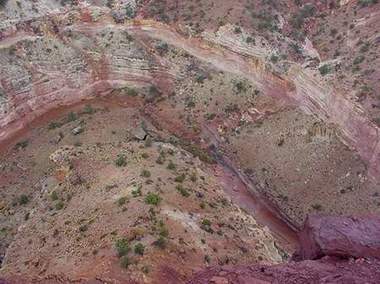 From
the top of the high mountain, it looked like a saucer or bowl with the
Fremont River going around it. [pix: gooseneck] Here too the trail going
up was marked with cairns.
From
the top of the high mountain, it looked like a saucer or bowl with the
Fremont River going around it. [pix: gooseneck] Here too the trail going
up was marked with cairns.
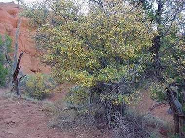
Flora and Fauna:
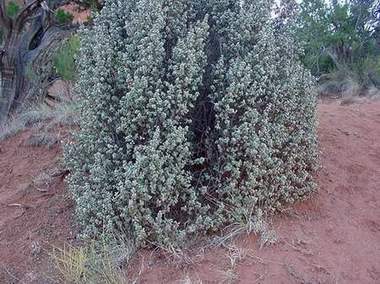
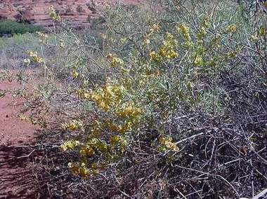
We did not see many animals in the parks because they are generally nocturnal, except the mule deer. It was abundant and behaved like a domesticated animal although it did not approach people. Ron gave us an adequate exposé on the animal and plant life in the area. One of the plants was prolific, pretty shrub with a bugle-like white flower, which opens in the dark to conserve moisture in the desert environment; as pretty as it is, it is poisonous. Bugs of red and black color were feeding on it. This color combination is a warning to humans not to eat these plants, and to birds not to mess with the bugs. The black widow spider is one kind of such bugs. The ladybug is not because its color is orange and black.
The porcupine likes to feed on tree bark especially the pinyin pine nut tree. It learned not to eat the bark all the way around so the tree would not die. It eats pieces of the bark all up the trunk. Smart animal!
One of the plants Ron pointed out to us was the yucca, which we have at our house. The blooming stock, and its big roots are edible. The leaf fiber is exceptionally strong. When he broke the needle at the end of the leaf or blade, a fiber peeled off with it. The Indians used the needle with its thread.
The buffalo berry bush is an interesting wild plant. It has many berries in the spring. Ron told us he picked, boiled and made marinade with the berries. He used the marinade on all kinds of meat.
Buffalo Berry Bush Mormon Tea
 |
 |
The Mormons do not indulge in stimulants, like coffee. Brigham Young allowed them to boil the needles of a shrub, which is now known as Mormons tea, because it had no caffeine. It was discovered later that it had ephedra, a more stimulanting substance than caffeine.
An interesting plant is the four-leaf Salt shrub. Its yellow bloom has four small leaves and a single seedpod in the center. Ron said that he picks them when mature and eats them like corn flakes when dried. I tried it off the shrub and it tasted like hay. The seed required harder chewing. I believe milk would have been helpful. There was a mild aftertaste that I could get used to.
Salt Brush Service Tree
 |
 |
The Service tree is the first plant to bloom in spring, after a long winter freeze. People could not bury their dead in the cold months, so they let the coffins sit until the spring thaw. They used the flower of the tree for funeral services, and hence the name. Brenda called it the funeral shrub or the death shrub.
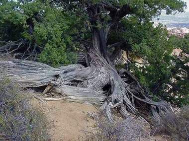
The wind on the plateaus, especially in Bryce, can be fierce, and lightning is spectacular. Some trees cannot withstand the force and twist. Many trees are completely and permanently twisted. The type of the tree or location is not a factor for this phenomenon; any tree anywhere can get twisted, while others are unaffected. Even the roots are sometimes twisted, because they become exposed due to erosion. In the desert, the trees received moisture as soon as the rain fell on the soil. Another strange phenomena was one kind of pine with reddish bark smells like vanilla. The smell was prominent.
Roots Twisted Tree
 |
 |
Conclusion:
I returned from my trip to Alaska in July 2000 feeling that it was the
best trip I made in many years. But it did not compare with the Utah hike.
This one was more physically demanding, climbing to 9100 feet where the
air is thin, and we were moving at a good pace, although we had frequent
rest stops. We hiked 51 miles in ten days. In one day, we hiked eleven
miles and climbed 1500 feet. We had daily surprises that gave us startling
views and drew oohs and aahs from all of us. Nature had done very intricate
and artistic magic with the terrain by erosion. It was not surprising that
the Mormons gave many of the places religious names. They simply commanded
reverence and awe. My companions were jovial and generally strong. They
were not hesitant to hike the Virgin River or go to the top of the very
rocky mountain to view Cassidys arch and walk over it. It is no doubt
that Ron deserved much of the credit for the success of our hike; he is
simply a great and
|
Sand Pipe
It was a geyser, which eroded
|
 |
St. George, Utah is in the lower left
corner